Arconic (ALCOA) Grasse River Superfund Site
The ancestral lands of the federally recognized Saint Regis Mohawk Tribe and Mohawks of Akwesasne, include land on both banks of the lower Grasse River and a tract of land along the confluence of the St. Lawrence River, as recognized by the 1796 Treaty with the Seven Nations of Canada, 7 Stat. 55, known as "Indian Meadows." The lower Grasse River, as well as associated land identified by the SRMT as the Indian Meadows, are of cultural importance to the Mohawks, Mohawks of Akwesasne, and the SRMT. Fishing, hunting, harvesting and spiritual ceremonies are among the activities that have been historically and are now conducted by the Mohawks of Akwesasne in the lower Grasse River.
The Site is located near the northern boundary of New York State in the Town and Village of Massena. It is not on the National Priorities List (NPL) but is being investigated and remediated as an enforcement-lead remedial action that follows the same investigation and remedy selection requirements as sites on the NPL. EPA issued an Administrative Order (Index II CERCLA- 90229) (Order) to Alcoa Inc. (Alcoa), Arconic's predecessor in interest, in September 1989, calling for the investigation of the Alcoa Study Area to determine the nature and extent of hazardous substances contamination. The Alcoa Study Area included approximately 7.2 miles of the lower Grasse River from the intersection of the Massena Power Canal (Power Canal) and the Grasse River, to the confluence of the Grasse and St. Lawrence Rivers. This 7.2 mile stretch of the Grasse River. The Alcoa Study Area also included the approximately 1.3 miles of the lower Grasse River upstream of the confluence of the Grasse River and the Power Canal, Robinson Creek (which discharges to the St. Lawrence River) and the Unnamed Tributary.
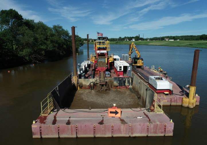
The Grasse River Remediation project completed the dredging and main channel capping activities in October of 2021. The project has moved from its remedial actions phase to it’s Operations, Maintenance, & Monitoring phase. During the spring thaw and ice break up in March of 2022, a significant ice jamming event took place in the project area causing a failure in the modified armored main channel cap just upstream of the Route 131 bridge. The surging water under the toe of the ice jam caused a scour of up to five feet into the native PCB contaminated sediment and transferred that sediment downstream to be deposited on top of the cap placed in 2021. Activities in 2022 focused on an interim measure of placing a cap over the exposed areas to limit any additional damage to the cap for the upcoming 2022/2023 winter. Over this winter, the stakeholders (USEPA, NYSDEC and SRMT) will make decisions on how best to repair the area and a full construction season on the river is expected in 2023.
Publications
-
Reports
- First Five-Year Review Report for Grasse River (aka ALCOA Aggregration) Superfund Site - April 2022
- Explanation of Significant Differences (ESD) Grasse River (aka Alcoa Aggregation) Superfund Site - April 2020
- Grasse River Snug Harbor Figures (ESD April 2020)
- Fact Sheet - Unnamed Tributary (Alcoa - June 2017)
- Grasse River Superfund Site Community Involvement Plan for Remedial Design and Remedial Action - August 2014
- Grasse River Superfund Site Record of Decision Announced - April 2013
- Education
- Links